
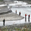
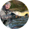
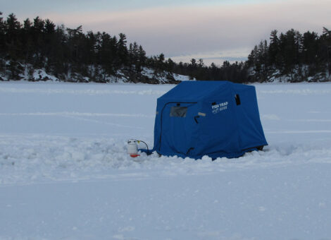
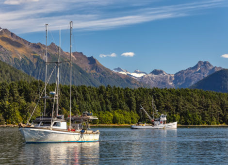
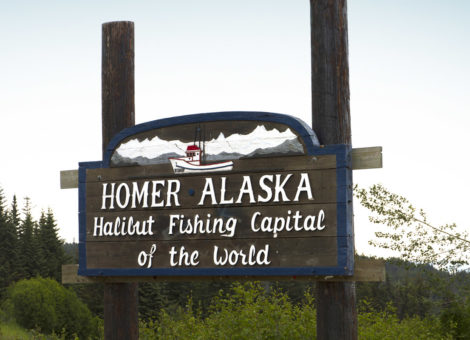
Prince William Sound hosts some of best halibut fishing anywhere in Alaska. What makes Prince William Sound one of Alaska’s top halibut fishing locations is it’s easy access and proximity to hundreds of bays, hidden coves and inlets teaming with halibut. Prince William Sound is accessible from Whittier, Valdez or Cordova — although most fisherman launch from Whittier. Whittier is an hours’ drive south from Anchorage and offers a harbor with over 300 permanent and transient slips where fisherman can dock their boats year round.
Out of Whittier fisherman have direct access to some of the best halibut fishing grounds in Prince William Sound including Ports Wells and the waters surrounding Lone Island. However, to reach some of the most productive halibut fishing grounds anglers will need to travel two to three hours by boat into the heart Prince William Sound.
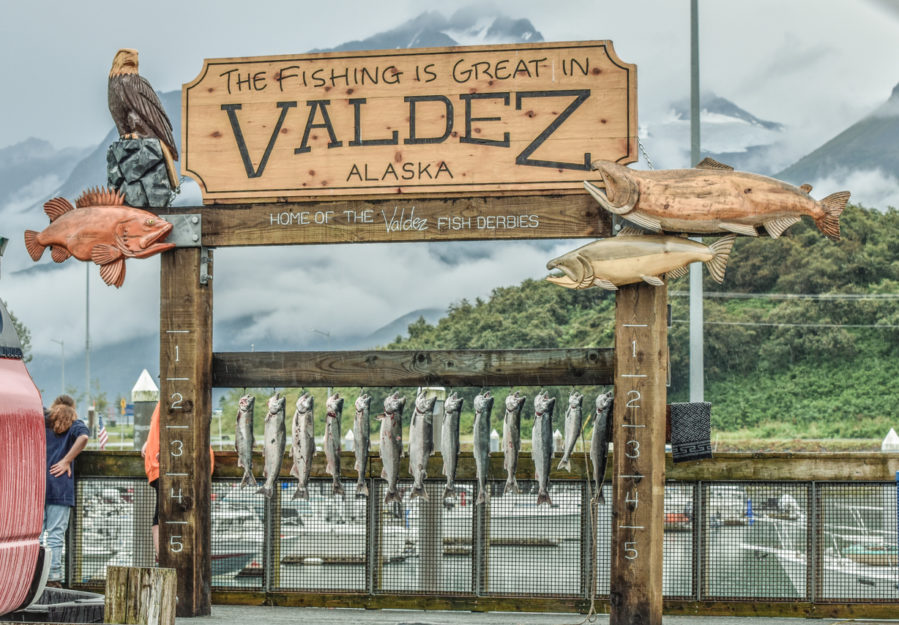
While not as popular as Whittier, Valdez is another popular destination for anglers looking to access some of the best halibut fishing waters in Prince William Sound. Valdez is a short 45 minutes flight from Anchorage and flights leave daily. There are also roads into Valdez from Anchorage, Tok and Fairbanks. Valdez provides quick access to some of the best halibut fishing spots in Prince William Sound, including Jack Bay, Port Fidalgo, Galena Bay, Knowles Head, and Bligh Reef.
Orca Bay and the north side of Hinchinbrook Island provide good halibut fishing for anglers based out of Cordova.
For the best halibut fishing in Prince William Sound you’ll want to visit Hinchinbrook Entrance, Montague Strait, and the far side of Montague Island. Anglers can obtain descent catches closer to port, but success rate and catch size climb as you near the Gulf of Alaska. Anchoring overnight and camping in a hidden cove or sheltered bay is a great way to get within striking distance of these fishing grounds.
The following interactive Prince William Sound Halibut Fishing Map provides the location and coordinates of the most of the top halibut fishing spots throughout the Sound. Click on the map, zoom in, then select a map marker learn more about a specific location.
The following table provides the name, a description and the coordinates for the halibut fishing spots in the above map. Click on the “Directions” link in the “Description” column to view the location in Google Maps.
| Name | Description |
|---|---|
| Shotgun Cove | Spotty for halibut Distance from Whittier: 6 miles Coordinates: 60.795779424381806, -148.55043998932928 Directions |
| Passage Canal | Focus on areas with rocky or gravelly bottom Distance from Whittier: 8.4 miles Coordinates: 60.8145533385789, -148.54285446839125 Directions |
| Decision Point | Fishing is best along the north side Distance from Whittier: 18 miles Coordinates: 60.807750075440865, -148.4511651482101 Directions |
| Blackstone Bay | Fish during incoming tide Distance from Whittier: 10 miles Coordinates: 60.74834776612897, -148.59525411354804 Directions |
| Cochrane Bay | Distance from Whittier: 14 miles Coordinates: 60.72950979380274, - 148.35388006661177 Directions |
| Culross Bay | Flat shorelines with a tide flat at the head of the bay. Watch out for shallow water. Protected from winds and swells Distance from Whittier: 24 miles Coordinates: 60.75118084055376, -148.16252354566362 Directions |
| Hidden Bay | Sheltered bay ideal for anchorage in bad weather Distance from Whittier: 24 miles Coordinates: 60.70689012465304, -148.16272306886424 Directions |
| Long Bay | Head end of bay offers protected anchorage Distance from Whittier: 22 miles Coordinates: 60.978810337101955, -147.23581941214815 Directions |
| Port Nellie Juan | Focus on the north side from East Finger Inlet to Mink Island Distance from Whittier: 30.8 miles Coordinates: 60.582888181041334, -148.222232310983 Directions |
| Kings Bay | Fish the waters of Nellie Juan River and the King River later in the season Distance from Whittier: 45 miles Coordinates: 60.53321220464643, -148.57582654008732 Directions |
| Deep Water Bay | Fish for halibut off the creek mouth. Drift the outgoing tide using bait or jigs Distance from Whittier: 42 miles Coordinates: 60.497683272483464, -148.3785456800167 Directions |
| Derickson Bay | Fish the plateaus and humps off the mouth of Derickson into Eaglek Bay Distance from Whittier: 38 miles Coordinates: 60.86767463783566, -147.80578173613537 Directions |
| Blue Fiord | Fish the sandy bottom located at the entrance of the bay Distance from Whittier: 41 miles Coordinates: 60.46586470275067, -148.24880476662355 Directions |
| McClure Bay | Fish the west of the point on the west side of the entrance during a a falling tide where the bottom drops into Port Nellie Juan. Distance from Whittier: 35 miles Coordinates: 60.51267553486823, -148.17125941523008 Directions |
| Main Bay | Halibut fishing is spotty Distance from Whittier: 35 miles Coordinates: 60.54157249761802, -148.06219721042788 Directions |
| Eshamy Bay | Fish the humps and plateaus off the mouth of the bay and to the north of Crafton Island Distance from Whittier: 41 miles Coordinates: 60.47091100869082, -147.97511789854124 Directions |
| Granite Bay | Fish the humps and plateaus off the mouth of the bay Distance from Whittier: 46 miles Coordinates: 60.918581521069655, -148.11375036399488 Directions |
| Dangerous Passage | Fish the plateau at the entrance near the north end of Chenega Island, as well as the entrances of Paddy Bay and Ewan Bay Distance from Whittier: 48 miles Coordinates: 60.35984044993019, -148.10542914751804 Directions |
| Jackpot Bay | Halibut are found throughout the bay Distance from Whittier: 56 miles Coordinates: 60.35486627633585, -148.23961518491237 Directions |
| Chenega Island | Fish the humps and plateaus throughout the Dangerous Passage during outgoing tide after salmon spawning season Distance from Whittier: 50 miles Coordinates: 60.3211463029424, -148.05973344380575 Directions |
| Whale Bay | Fish the outgoing tide after salmon spawning season. The best halibut fishing area is from the eastern headland at the entrance of Whael Bay, south, and east to Pt. Countess Distance from Whittier: 61 miles Coordinates: 60.22512268489361, -148.17989970197738 Directions |
| Brainbridge Island | Fish around the island. Fish the plateaus off the north end of the island just southwest of Gage Island and southeast of Bainbridge point, including Bainbridge Passage. Fish at the downstream side of Amerk Point in the deeper water Distance from Whittier: 68 miles Coordinates: 60.10566455188112, -148.14962253306985 Directions |
| Sawmill Bay | Fish the humps and plateaus north of Bettles Island and along the eastern side of Latouche Passage Distance from Whittier: 75 miles Coordinates: 61.064104704852, -146.7831196650519 Directions |
| Latouche Island | Fish around the south end of the island Distance from Whittier: 70 miles Coordinates: 59.943714119667696, -147.96954338195465 Directions |
| Port Chalmers | Fish the steep drop that extends between Stockdale Harbor and Green Island. Fish the plateaus and humps north and west of Port Chalmers Distance from Whittier: 70 miles Coordinates: 60.23879324344452, -147.26961898858406 Directions |
| Snug Harbor | Drift for halibut on the outgoing tide of the mouth of the stream following salmon spawning season as the salmon die off. Fish the shallow humps of the harbor mouth situated just south of Discovery Point and north and east of the bay Distance from Whittier: 68 miles Coordinates: 60.251340392317324, -147.73887085231226 Directions |
| Drier Bay | Fish the humps near the mouth of the bay and outside the mouth where the bottom drops off to deeper water Distance from Whittier: 52 miles Coordinates: 60.31631471736464, -147.81267710204088 Directions |
| Bay of Isles | Fish the humps, shelves and holes found throughout the bay Distance from Whittier: 52 miles Coordinates: 60.39967845765041, -147.66451473456777 Directions |
| Lower Herring Bay | Focus fishing on the humps off the mouth of the bay and the drop-off into Knight Island Passage Distance from Whittier: 49 miles Coordinates: 60.38997458555687, -147.8126618304756 Directions |
| Herring Bay | Fish the shoreline rockpiles and around the islands located at the head of both arms of the bay. Fish the dropoffs on both sides of the bay entrance Distance from Whittier: 45 miles Coordinates: 55.3259179963937, -131.5211969310443 Directions |
| Bass Harbor | Fish the plateaus and humps throughout the area Distance from Whittier: 48 miles Coordinates: 60.6419798624412, -147.402220912776 Directions |
| Outside Bay | Fish the humps and plateaus directly off the mouth of the bay, and north toward Cabin Bay Distance from Whittier: 45 miles Coordinates: 60.64468459849565, -147.4660782105909 Directions |
| Cabin Bay | Fish the shallow humps and plateaus found throughout the bay Distance from Whittier: 45 miles Coordinates: 60.669434559877736, -147.49707674322931 Directions |
| McPherson Bay | fish the humps in the bay Distance from Whittier: 48 miles Coordinates: 60.67423745016302, -147.36633334092957 Directions |
| South Bay | Fish off the headland on the east side of the bay, around Meares Point and the plateau off the entrance to the bay Distance from Whittier: 31 miles Coordinates: 60.66903656028485, -147.91385714667933 Directions |
| West Twin Bay | After salmon spawning season fish the middle of the bay where the botto drops off during outgoing tide. Fish the plateau that extends east of Egg Rocks Distance from Whittier: 25 miles Coordinates: 60.72140464526665, -147.98186475316004 Directions |
| East Twin Bay | Fish the entire bay and near the river at the head of the bay after salmon start to die off. Fish the mouth of the bay where the bottom drops off. Fish the shallower waters south and west of Fool Island Distance from Whittier: 28 miles Coordinates: 60.73302912285616, -147.93840937784844 Directions |
| Eaglek Bay | Fish the edges of the shelf at the mouth of the bay Distance from Whittier: 35 miles Coordinates: 60.87026528060101, -147.7220967575243 Directions |
| Squaw Bay | Fish the plateau at the entrance to the bay and the edges where it drops off to deeper water Distance from Whittier: 30 miles Coordinates: 60.83434784754296, -147.8282926250766 Directions |
| Esther Passage | Fish the numerous humps and plateaus at the southern entrance to Esther Passage. Fish the edge of the dropoff at the northern end of the passage Distance from Whittier: 30 miles Coordinates: 60.88792165536299, -147.94393940859413 Directions |
| Esther Bay | Fish the drop off at the entrance to Esther Bay Distance from Whittier: 25 miles Coordinates: 60.805659332440705, -147.9764274443492 Directions |
| Lake Bay | Fish along the edge of the drop off at the entrance to Lake Bay Distance from Whittier: 22 miles Coordinates: 60.79864522739243, -148.08683881335222 Directions |
| Granite Bay | Fish the edges of the drop off at the mouth of the bay Distance from Whittier: 22 miles Coordinates: 60.89497253992625, -148.10484501306178 Directions |
| College Fiord | Fish the drop off to the west of College Fiord, as well as the underwater peninsulas that extend from the northeast and southwest sides of the fjord Distance from Whittier: 31 miles Coordinates: 61.12473052897058, -147.92870699734522 Directions |
| Coghill River | Fish just off the shelf south of Coghill River in the deeper water (80-100 feet). Best time to target halibut is July or following the salmon runs Distance from Whittier: 36 miles Coordinates: 61.07043374785484, -147.92354137307188 Directions |
| Harriman Fjord | Fish the edges of the submerged glacial moraine that extends across the entrance to Harriman Fjord. Fish the edges of this shelf where it drops off to deeper water on the Barry Arm side Distance from Whittier: 33 miles Coordinates: 61.06932339890915, -148.270100062174 Directions |
| Port Wells | Fish the humps off the mouth of Pigot Bay, the shoal at the mouth of Barry Arm, the Esther Rock area, and the entrance to College Fjord Distance from Whittier: 17 miles Coordinates: 60.8702827368664, -148.20412670429494 Directions |
| Pigot Bay | Fish the entire bay and the three seamounts of the entrance to the bay Distance from Whittier: 15 miles Coordinates: 60.84224976107322, -148.3537737197293 Directions |
| Hinchinbrook Island | Fish the north side of the island for protection from the wind Distance from Valdez: 53 miles Coordinates: 60.44447907254719, -146.75857245927904 Directions |
| Hinchinbrook Entrance | Fish the entrance to the Gulf of Alaska Distance from Cordova: 43 miles Coordinates: 60.327684223755654, -146.77859234178905 Directions |
| Port Etches | Fish the entire bay and toward Hichinbrook Entrance Distance from Cordova: 45 miles Coordinates: 60.33648463905183, -146.591639973126 Directions |
| Montague Island | Fish the far side of Montague Island bording the Gulf of Alaska Distance from Cordova: Approx. 55 miles Coordinates: 60.069266662955506, -147.4716489276189 Directions |
| Montague Strait | Fish the South West end of Montague Straight Distance from Whittier: Approx 70 miles Coordinates: 60.00085663158459, -147.74991426445158 Directions |
| Jack Bay | Fish near the entrance of the bay Distance from Valdez: 10 miles Coordinates: 61.037418270245055, -146.64104347951914 Directions |
| Galena Bay | Fish the mouth of Galena Bay, roughly 75 yards from the rocks. Concentrate along the steep drops on both sides of the entrance Distance from Valez: 19.5 miles Coordinates: 60.94400553121402, -146.69940837602704 Directions |
| Valdez Narrows | Halibut over 100 lbs caught here Distance from Valdez Harbor: 9.5 miles Coordinates: 61.06977037743299, -146.66963636931757 Directions |
| Port Valdez | Halibut over 100 lbs caught here Distance from Valdez: 3 miles Coordinates: 61.12360544382133, -146.47785983035828 Directions |
| Valdez Arm | Halibut over 100 lbs caught here Distance from Valdez Harbor: 14 miles Coordinates: 60.97407333608115, -146.81222509897648 Directions |
| Sawmill Bay | Fish the humps and plateaus north of Bettles Island and along the eastern side of Latouche Passage Distance from Valdez harbor: 16.2 miles Coordinates: 61.05670106107523, -146.7839215090009 Directions |
| Bligh Reef | Check the weather forecast before fishing this area Distance from Valdez harbor: 29 miles Coordinates: 60.85125820726043, -146.87763974895472 Directions |
| Knowles Head | Fish the trough west of the headland, toward Goose Island Distance from Valdez harbor: 40 miles (via Tatitlek Narrows) Distance from Cordova: 38 miles Coordinates: 60.68254767765245, -146.62123773976552 Directions |
| Knowles Bay | Best for day fishing only. No where to anchor or camp Distance from Valdez harbor: 42 miles (via Tatitlek Narrows) Coordinates: 60.68176878586576, -146.55432288625553 Directions |
| Red Head | Fish the rocky flats to the south Distance from Valdez harbor: 57 miles (via Tatitlek Narrows) Distance from Cordova: 37 miles Coordinates: 60.67209294110268, -146.5026265397967 Directions |
| Port Gravina | Some halibut found here Distance from Valdez harbor: 55 miles (via Tatitlek Narrows) Distance from Cordova: 35 miles Coordinates: 60.690549301671616, -146.32929199047948 Directions |
| Squaw Bay | Fish the plateau and the edges where it drops off to deeper water Distance from Whitter: 20 miles Coordinates: 60.83627189636366, -147.83103920684678 Directions |
| Unakwik Inlet | Fish the lower bay, towards the entrance concentrate on the steeper drops along both sides of the inlet Distance from Whittier: 38 miles Coordinates: 60.901137093874326, -147.57099972024116 Directions |
| Glacier Island | Fish along the steep drops off Iceberg Point and in Chamberlain Bay Distance from Valdez harbor: 29 miles Coordinates: 60.957254250373424, -147.23469980812527 Directions |
| Columbia Bay | Focus fishing toward the entrance of Columbia Bay, along Flent Point and Elf Point, at the mouth of the bay Distance from Valdez harbor: 29 miles Coordinates: 60.98563783391988, -147.07913703601102 Directions |
| Port Fidalgo Inlet | Fish near the entrance to the inlet Distance from Valdez Harbor: 20 miles Coordinates: 60.802108237133375, -146.47410048724367 Directions |
| Orca Inlet | Distance from Cordova Harbor: 3 miles Coordinates: 60.53070369931533, -145.84781562442362 Directions |