
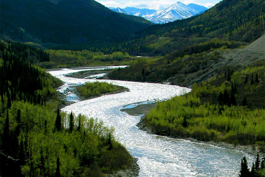
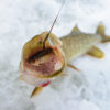
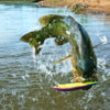
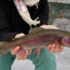
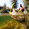
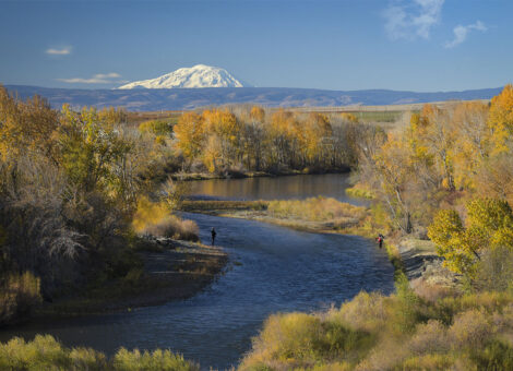
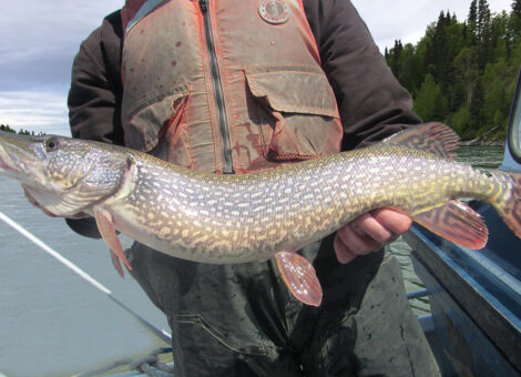
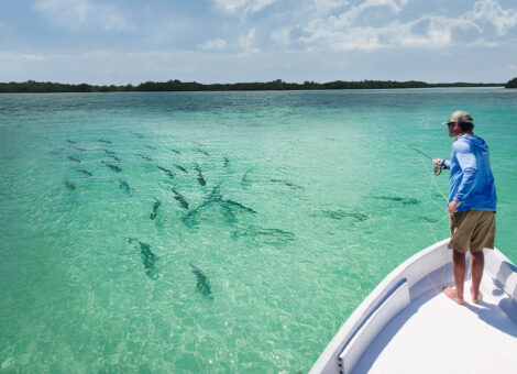
The Kenai river is just over 83 miles long. The river begins at its mouth near the Cook Inlet (RM 0) and extend east until it reaches Cooper Landing (RM 83). There are over 40 species of fish found throughout the Kenai river. The most popular sport fish in the Kenai include Pacific salmon (King, Coho, Sockeye and Pink), rainbow trout and Dolly Varden. To maximum your catch rate, abide by fishing regulations, and have an overall enjoyable fishing experience it’s important to know the public access points along Kenai and be familiar with the specific regulations for each section of the river.
- Kenai River Fishing Access Points and Map
- Lower Kenai Access Points (RM 0 – RM 21)
- Middle Kenai Access Points (RM 22 – Skilak Lake)
- Upper Kenai Access Points (Skilak Lake – RM 83)
- Fishing Regulations (by River Mile)
Kenai River Access Points and Fishing Map
There are 36 public access points along the Kenai river where anglers can either fish from shore or launch a boat to fish on the open river. Each access poins is located at a specified River Mile (RM). A “River Mile” is the measure of distance in miles along the river to the access point from the mouth of river (RM 0). Identifying the RM of an access point provides a reference for knowing how far up the river the access point is located and enables an angler follow fishing regulations for a given section of the river.
The following is a comprehensive and interactive map with markers for each of the 36 public access points along the Kenai River. To learn more about an access point, click on the marker and a popup will appear with additional details—including the River Mile. Below the map, we’ll provide additional information about the sections of the Kenai river.
Lower, Middle and Upper Kenai River Fishing Access Points
The Kenai River has three designated sections: Upper Kenai, Middle Kenai, and Lower Kenai. The Upper Kenai is 18 miles long and runs southwest from Cooper Landing (RM 83) down to the Skilak lake. The Middle Kenai is 20 miles long and extends from Skilak Lake west to Soldotna bridge (RM 21). The Lower Kenai zigzags west from Soldotna bridge (RM 21) until it reaches the mouth of the Kenai River (RM 0) at Cook Inlet.
For purposes of simplicity, below we’ve listed the three sections of Kenai river, and their corresponding access points, in numerical order starting with RM 0 and ending with RM 83. This will help you get a complete picture of the available fishing opportunities starting at the mouth of Kenai river working up to Cooper Landing where Kenai River joins Kanei Lake.
- Lower Kenai (RM 0 – RM 21)
- Middle Kenai (RM 22 – Skilak Lake)
- Upper Kenai (Skilak Lake – RM 83)
Lower Kenai (RM 0 – RM 21)
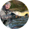
The Lower Kenai is where most fishing activity occurs. During the King salmon runs, this section of the Kenai can get very crowded with eager anglers. The King salmon runs on the Lower Kenai have been referred to as the “Super Bowl” of King Salmon fishing. While the Lower Kenai is mostly known for Salmon fishing, it still offers decent rainbow trout fishing. The final 12 miles of the Lower Kenai also offers fishing for intertidal species of fish such as Halibut.
The Lower Kenai offers several public access points where anglers can fish from the rivers edge for Salmon, rainbow trout and Dolly Varden. Anglers can fish the Lower Kenai from shore, drift boat or motor boat. There are several access points along the Lower Kenai to launch a boat.
- RM 0 – Kenai River Mouth
- RM 2 – City of Kenai (City Dock)
- RM 3 – Kenai Landing
- RM 5 – Kenai River Flats
- RM 6.5 – Cunningham Park
- RM 11.25 – Eagle Rock
- RM 12.5 – Pillars Boat Launch
- RM 15.5 – Ciechanski Day Use Area
- RM 16.5 – Big Eddy
- RM 19 – Slikok Creek (State Park)
- RM 20.4 – Centennial Park
- RM 21 – Soldotna River Walk
Kenai River Mouth RM 0
Surf-cast for salmon and other species from the beach at the mouth of Kenai River. A net salmon fishery takes place from late June through July for local residents. Dipnetting is permitted in the mouth of Kenai River on the Cook Inlet side. Access the north bank heading south on Spruce Drive in Kenai. Access the south bank on Kalifornsky Beach Road to Cannery Road.
Coordinates: 60.55457164304122, -151.27430503616455
Directions
City of Kenai Boat Launch (City Dock) RM 2
Provides boat Launch, restrooms and drinking water. Located at 1591-1571 Boat Launch Rd, Kenai, AK 99611.
Coordinates: 60.54501217486526, -151.22147829546537
Directions
Kenai Landing RM 3
Riverbank fishing from the Cook Inlet side on the beach or inside the mouth of Kenai River to the east. Located at 2101 Bowpicker Ln, Kenai, AK 99611 near The Cannery Lodge.
Coordinates: 60.532188386773214, -151.25599015461165
Directions
Kenai River Flats RM 5
Provides picnic area, restrooms and intertidal riverbank fishing on the Kenai River at the DNR State Parks’ Kenai Flats State Recreation Site. Located at the southern end of the Warren Ames Bridge between Kalifornsky Beach Road and the city of Kenai. Take the Seward Hwy South, bear right onto the Sterling Hwy South, turn right onto Kalifonsky Beach Road, access at the Bridge Access Road.
Coordinates: 60.523760846715064, -151.21006289969273
Directions
Cunningham Park RM 6.5
Easy-access for sockeye and coho fishing on the Kenai River. Cunningham park is particularly popular for silver salmon fishing in the fall. The bank is a mix of gravel and mud. Since this is a tidal area, mud is more prevalent during low tide. As the water lowers and rises with the tide, anglers are regularly required to adjust their bait setup. Cunningham Park is located just outside of Kenai down Beaver Loop Road. There are restrooms onsite
Coordinates: 60.54144973565513, -151.18309735767835
Directions
Eagle Rock RM 11.25
There is good fishing just upstream from Eagle Rock in early May. An estimated 40% of the late King salmon run occurs between Eagle Rock (RM 11.25) and Soldotna bridget (RM 21). Eagle Rock provides boat launch, restrooms and drinking water. Located at GVXQ+5J Eagle Rock Boat Launch, Kenai, AK. Mile 5 of Kenai Spur Highway.
Coordinates: 60.547945596167004, -151.10958335767197
Directions
Pillars Boat Launch RM 12.5
Provides access by boat to several popular fishing holes on the Lower Kenai. Provides state boat ramp, restrooms and drinking water. Located at 155 Silver Salmon Dr, Kenai, AK 99611. Mile 4.2 of Kenai Spur Highway.
Coordinates: 60.53426108824704, -151.0973398150223
Directions
Ciechanski Day Use Area RM 15.5
Provides opportunities for salmon fishing for boaters as well as riverbank fishing. Restrooms and picnicking amenties available.
Coordinates: 60.513492791353116, -151.11654581534393
Directions
Big Eddy RM 16.5
Public access to fish from the river bank of the Kenai. Restrooms and picnicking amenties available. Take Sterling Highway to Soldotna. Turn on Kenai Spur Highway to Big Eddy Road.Locate at 46599 Big Eddy Rd, Soldotna, AK 99669
Coordinates: 60.50738997302008, -151.12049426622087
Directions
Slikok Creek (State Park) RM 19
Provides riverbank fishing access to Slikok Creek and Kenai River confluence. Restrooms onsite.
Coordinates: 60.48149140945298, -151.13046344343041
Directions
Centennial Park RM 20.4
Offers great riverbank fishing for sockeye and coho salmon. A few monster Kings have been caught here as well. Provides camping, RV dump station, boat ramp, restrooms and drinking water. Take Sterling Hwy to Centennial Park Road. Follow to Kenai River.
Coordinates: 60.479913876457715, -151.09272620000004
Directions
Soldotna River Walk RM 21
Soldotna Park, in downtown Soldotna, riverbank fishing for all salmon species but sockeye is the target fish. Located at 44790 Sterling Hwy, Soldotna, AK 99669.
Coordinates: 60.476757399799624, -151.0827039067195
Directions
Middle Kenai (RM 22 – Skilak Lake)
Compared to the Upper and Lower sections of the Kenai river, the Middle Kenai offers limited access for anglers to fish from shore. The Middle Kenai is mostly fished by boat. Anglers use a mix of drift boat/rafts and motor boats to reach the best fishing holes along the Middle Kenai.
The Middle Kenai offers excellent opportunity to fish for salmon, rainbow trout and Dolly Varden. Moose River (RM 26) upstream to Skilak lake is where you’ll find the best fishing for giant rainbows and Dolly Varden. Salmon fishing is best during the salmon runs.
- RM 22 – Soldotna Creek Park
- RM 22 – Donald E. Gilman River Center
- RM 23 – Swiftwater Park
- RM 23.5 – Soldotna Rotary Park
- RM 26 – Moose Range Meadows
- RM 27.5 – Keystone Boat Launch
- RM 30.5 – Funny River Campground
- RM 31 – Morgan’s Landing Campground
- RM 36.4 – Izaak Walton Campground
- RM 39.5 – Bing’s Landing
- RM – Lower Skilak Lake Campground
Soldotna Creek Park RM 22
2,300 feet of riverfront boardwalk and 12 sets of river access for riverbank fishing. Located at 315 Endicott Dr, Soldotna, AK 99669. Restrooms onsite.
Coordinates: 60.48405637594689, -151.05823836190459
Directions
Donald E. Gilman River Center RM 22
Kenai River fishing access area behind the Donald E. Gilman River Center. Located at 514 Funny River Rd, Soldotna, AK 99669.
Coordinates: 60.48004654050866, -151.04187573068788
Directions
Swiftwater Park RM 23
Easy-access to riverbank fishing for sockeye, coho and pink salmon. King salmon occassionally. Offers boat launch, camping and picnic area. Located off East Redoubt Ave near the intersection of Sterling Hwy and Kenai Spur Hwy.
Coordinates: 60.48299290794911, -151.0420360565568
Directions
Soldotna Rotary Park RM 23.5
Offers excellent riverbank fishing for sockeye, silver (coho) or pink salmon. Located at 884 Funny River Road.
Coordinates: 60.47980573551367, -151.01764261534393
Directions
Moose Range Meadows RM 26
Riverbank fishing for sockeye from the pier. Located at 33697 Keystone Dr, Soldotna, AK 99669.
Coordinates: 60.46720171987912, -150.96576323280308
Directions
Keystone Boat Launch RM 27.5
Located at the end of Keystone Dr. Provides both boat access and riverbank fishing on the Kenai.
Coordinates: 60.46658647611374, -150.93427266956127
Directions
Funny River Campground RM 30.5
Riverbank fishing for sockeye and coho salmon fishing. Camping, picnic area, restrooms and drinking water available. Located at 37684 Funny River Rd, Soldotna, AK 99669. Restrooms, camping (Call 907-269-8400)
Coordinates: 60.492760353965, -150.8616818613758
Directions
Morgan’s Landing Campground RM 31
Great salmon fishing from the riverbank. Picnic area, restrooms, camping, drinking water. Located at Milepost 80-88 3.1 miles off Sterling Hwy next to the Kenai River. There is a trail to the board walk. Address is 35850 Lou Morgan Rd Soldotna, AK 99672.
Coordinates: 60.50080327202523, -150.8658196692539
Directions
Izaak Walton Campground RM 36.4
Here the Moose River meets the Kenai River. Riverbank fishing for sockeye, pinks, kings, silver salmon, and rainbow trout and Dolly Varden. Several access point below the Kenai-Moose River confluence. Offers boat launch, camping, picnic area and drinking water. Milepost 81, Sterling Hwy, Sterling, AK 99672
Coordinates: 60.53586439127396, -150.75096655112213
Directions
Bing’s Landing RM 39.5
Riverbank fishing, boat launch, restrooms, picnic area, camping and dringking water. Take Sterling Hwy to Bings Landing Rd. Follow Bings Landing Rd to Kenai River. Offers excellent Sockeye fishing. Mile 80.5 on Sterling Hwy.
Coordinates: 60.515873608614555, -150.7011746792962
Directions
Lower Skilak Lake Campground
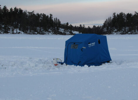
Provides bank access to the Kenai River year round. Take Sterling Hwy to Skilak Lake Rd. Take Sterling Lake Rd to Lower Skilak Campground Rd. Follow Lower Skilak Campground Rd. to Kenai River. Full campground with restrooms and drinking water. Access at Mile 58 on Sterling Highway.
Coordinates: 60.47210532306719, -150.4707429312535
Directions
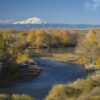
Upper Kenai (Skilak Lake – RM 83)
The Upper Kenai runs through a National Wildlife Refuge, so there isn’t a lot of private property boarding this section of the river and there is a lot of public access. The Upper Kenai offers the best walk in option for anglers. Anglers who fish the Upper Kenai by boat use drift boats or rafts, as this section of the Kenai is float only.
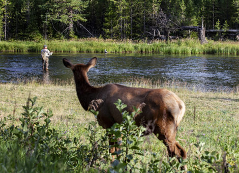
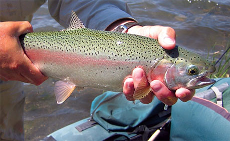
While Sockeye and Coho salmon runs reach the Upper Kenai each year, this section of the river is mostly known for its exceptional Dolly Varden and rainbow trout fishing. Trophy rainbow trout are prevalent from Skilak lake upstream to Kenai Lake. Most fly-fishing takes place on the Upper Kenai.
- Upper Skilak Lake Campground
- RM 69.5 – Jim’s Landing
- RM 71 – Riverbank Pullout
- RM 73.5 – Sportsman’s Landing / Russian River Ferry
- Russian River Campground
- RM 79 – Cooper Creek Campground
- RM 83 – Cooper Landing
- Quartz Creek
Upper Skilak Lake Campground
Public access to Skilak lake for bank fishing and boat launch. Restrooms and drinking water are available. Access at Mile 75 on Sterling Highway.
Coordinates: 60.43964182607896, -150.3208811846561
Directions
Jim’s Landing RM 69.5
Popular spot for boaters to put in or take out to fish the Kenai River. Limited bank access for fishing. Restrooms available. Day use only. Access off Shilak Lake Loop Road about Mile 58 on Sterling Hwy.
Coordinates: 60.48232363332574, -150.1150832
Directions
Riverbank Pullout RM 71
Riverbank fishing along Upper Kenai River near Mile 57 off Sterling Highway at River Mile 71. No facilities.
Coordinates: 60.484733265915, -150.07162773022253
Directions
Sportsman’s Landing / Russian River Ferry RM 73.5
Public access to the Kenai for riverbank fishing opposite Sportsman’s Boat Ramp. Restrooms and picnic area. Located at 12455 Sterling Hwy, Cooper Landing, AK 99572. Access at Mile 55 off Sterling Highway.
Coordinates: 60.48558951505057, -150.00621102870286
Directions
Russian River Campground
Public access for riverbank fishing. Restrooms available. Boardwalk and trail along Russian River to the Kenai River. Located at the end of Russian River Campground Rd. Access at Mile 52.5 off Sterling Highway.
Coordinates: 60.48432242102778, -149.98009652868856
Directions
Cooper Creek Campground RM 79
Riverbank fishing for Sockeye salmon. Restrooms and camping. Located at Milepost 50.7 of the, Sterling Hwy, Cooper Landing, AK 99572.
Coordinates: 60.48425773028107, -149.88531374748382
Directions
Cooper Landing RM 83
Riverbank fishing for King Salmon, Silver Salmon, Sockeye Salmon, Pink Salmon, Trophy Rainbow Trout & Dolly Varden. Public boat ramp. Restrooms and drinking water available. Access at Mile 47.5 on Sterling Highway just before Cooper Landing.
Coordinates: 60.49198840330917, -149.81104225492587
Directions
Quartz Creek
Shore fishing for Dolly Varden and rainbow trout. Camping, restrooms and public boat launch for Kenai Lake. (Salmon fishing not permitted.)
Coordinates: 60.478091775735464, -149.72651756943935
Directions
Fishing Regulations
When fishing the Kenai River it’s important to take not of where you’re at any give time to make sure you’re following fishing regulations for that section of the river. Below are the general regulations per River Mile on Kenai. (Note for a more complete list of regulations visit Alaska.gov Kenai River regulations).
| River Mile | Fishing Regulations |
|---|---|
| RM 0 | Open to dipnetting from shore (on the Cook Inlet side) |
| RM 1 to Warren Ames Bridge | Closed to dipnetting |
| RM 1.5 to RM 4 | 4 stroke, 2 stroke DFI or Electric Motor |
| RM 4 to RM 5 | 2 stroke or 2 stroke DFI or Electric Motor with 50 HP limitation |
| RM 11 to RM 12 | Back-trolling is prohibited from July 1-31 |
| RM 19 | Closed to fishing for King salmon or from boat fish May 1 - July 31. Fishing only allowed using artificial flies. |
| RM 20 to RM 21 | Close to fishing from boat May 1 - July 31 |
| RM 21 | Soldotna Centennial Campground boat launch lagoon closed to fishing July 1 - Aug 30 |
| RM 28.5 to 30.5 | Closed to fishing for King salmon or from boat fish May 1 - July 31 |
| RM 31 (Morgan's Hole) | 100 yards downstream from the landing at Morgan’s Hole upstream to ADF&G marker at north section line of Section 28, T5N, R9W closed to boat fishing May 1 - July 31. |
| RM 36.3 (Moose River Confluence) | 100 yards downstream of the mouth of the Moose River, upstream to ADF&G markers about 100 yards upstream of the mouth of the Moose River closed to fishing from boat May 1 - July 31. |
| RM 43 (Lower Killey River Confluence) | 3/4 miles downstream from Lower Killey River and about 1 mile upstream from Lower Killey River closed to King salmon fishing or boat fishing May 1 - July 31. Only artificial flies allowed. |
| RM 44 | From ADF&G marketing 1 mile upstream of Lower Killey River to Skilak Lake closed to all fishing May 1 - Jun 10. |
| RM 47 | From the swan sanctuary sign at about RM 47 to the Skilak Lake outlet at about RM 50 all fish closed from an anchored boat. |
| RM 50 | Skilak Lake closed to King salmon fishing, except within 1/2 mile of the upper Kenai River inlet. |
| RM 66 | From the Upper Kenai River inlet on Skilak Lake (about RM 66) to RM 80 drift area only, no motor use allowed |
| RM 73.4 | Upstream from Powerline to ADF&G markers downstream of the Kenai-Russian River Ferry June 11 - Aug 20 artificial flies only; May 1 - June 10 closed to all fishing; June 11 - Aug 20 ope to sockeye fishing; July 1 - Oct 31 open to coho fishing |
| RM 73.5 | From ADF&G markers located downstream of the Kenai-Russian River Ferry to ADF&G markers 300 yards upstream of the Sportsman's Landing boat launch is designated as "The Sanctuary" area. May 1 - July 14 closed to all fishing; July 15 - Aug 20 only artificial flies allowed; July 15 - Aug 20 open to fishing sockeye or coho salmon; Aug 21 - Oct 31 open to coho fishing. |
| RM 80.7 | From RM 80.7 to Kenai Lake (RM 82) unrestricted horsepower, 5 mph maximum, no wake area |