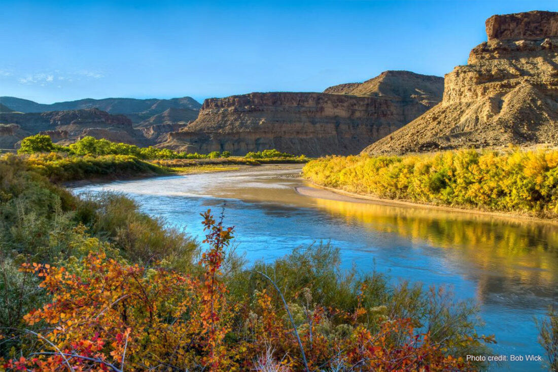
The Green River is a world-famous fly-fishing destination thanks to its incredibly clear water and blue ribbon trout fishery. Access can be challenging due to the mountainous terrain, but anglers can reach the river at a causeway just below Flaming Gorge dam, at Little Hole Recreation Area, Indian Crossing, and Browns Park.
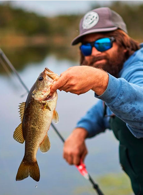
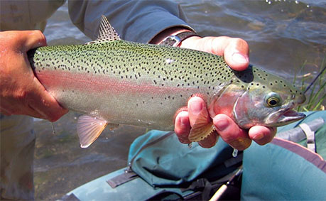
The river is well-populated by rainbow trout below the dam and brown trout farther downstream, plus a few cutthroats here and there. Only artificial flies and lures may be used on the Green River. Harvest numbers are limited while catch-and-release is encouraged.
The most popular stretch of the Green River for fly fishing runs 27 miles from Wyoming through Utah along the north slope of the Uinta Mountains. River flows can vary from from month to month and day to day. Water temperatures hover between 40 and 60 degrees year round.
The preferred method for fishing the Green River is by drift boat or raft, although there is ample opportunity to fish from shore—especially right below Flaming Gorge dam, where sight fishing and “matching the hatch” is the name of the game.
Before planning your fly fishing adventure, review the Green River hatch chart to see what trout are feeding on and an up-to-date fishing report.
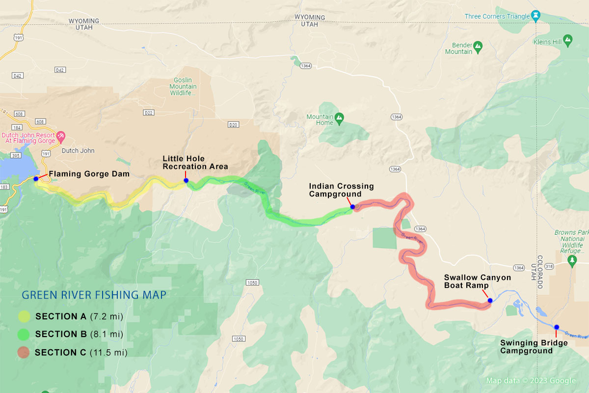
Green River Sections A, B, and C
The most popular and prolific fishery along the Green River extends from Flaming Gorge dam downstream to the Colorado border. This is the best stretch of the Green River to target giant browns and rainbow trout. It is divided into three sections: Section A, Section B, and Section C.
Section A – Fishin’ in an angler’s paradise
When anglers refer to the “Green River below Flaming Gorge” they are typically referring to Section A. Section A runs 7.2 miles from Flaming Gorge dam to Little Hole recreation area. The first few miles of Section A are characterized by long runs, deep pockets, and slow moving water. The middle and lower stretches are characterized by high gradient, rapids, and pocket water. Section A has crystal clear pools, a breathtaking canyon, and the highest density of trout anywhere on the Green River. It can be accessed by trail just below the dam and wade fished or float fished by drift boat.
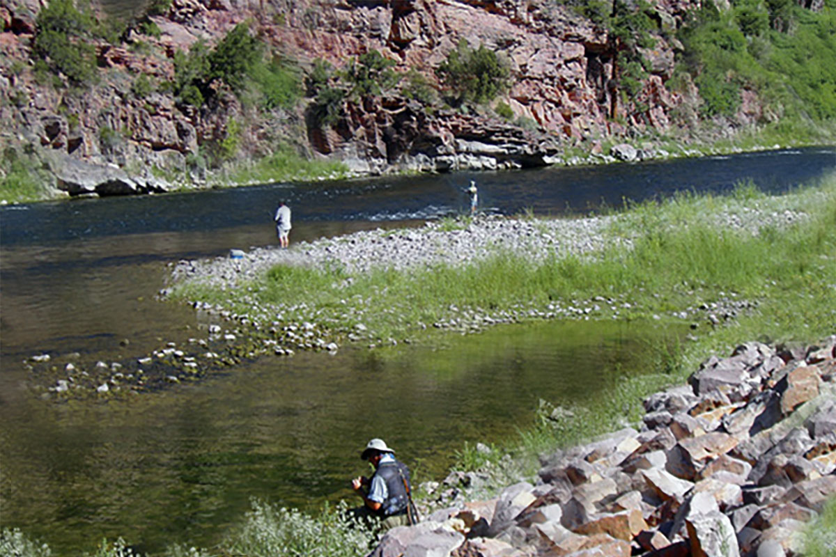
Section A offers unparalleled sight fishing opportunity. The water here is so clear that you can easily spot trout 8 feet below the surface. The Great American Rockies are known for their pristine rivers with high water clarity, but the water clarity along this stretch of the Green is unreal. You’ve got to see it to believe it.
The major catches along Section A are brown and rainbow trout—and there’s a lot of them. We’re talking thousands upon thousands of trout per mile in crystal clear water. If you’re lucky you may reel in a cutthroat or two. Whitefish and Carp are also found along this section of the Green but are rare.
Insect hatches are prolific throughout the spring and summer months. Look for what fish are feeding on and match the hatch. The largest spring hatches are going to be Blue Winged Olives (BWOs), Pale Morning Duns (PMDs) and Stoneflies. Scuds and midge patterns are productive throughout the year. During later summer focus on cicada, hopper, and ant patterns.
For shore and wade anglers, the Little Hole Trail that runs from just below the dam to Little Hole provides great shore and wade access. And for those not as inclined to wet their line (i.e. kids and significant others) the trail offers grassy banks for relaxing and the opportunity to view a variety of scenery and wildlife including giant pondera pines, towering redstone walls, deer, mountain goats, birds of prey, and an occassional river otter.
There is a relatively small, yet somewhat challenging, ClassII+ rapid aptly named the “mother-in-law” rapid toward the end of the section. It’s not a difficult rapid to navigate, but don’t let it blindside you.
Section B – The big daddy of rapids
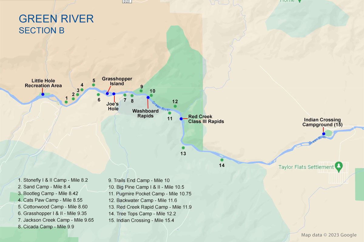
Section B begins where Section A ends at Little Hole and continues 8 miles downstream to Indian’s Crossing at Browns Park. The river flattens, the water slows, and fish concentrations decline. But what is lost in numbers is made up for in size. Trout along this section of the Green (as well as Section C) are often substantially bigger than those found in Section A.
The majority of anglers float fish this section of the Green. As you move down Section B the crowds disappear and fishing pressure drops dramatically. The high red cliff walled canyon of Section A eventually gives way to the calm meandering meadow stream at the tail end of Section B. Insect life here is abundant and flies and terrestrials are the mainstay of trouts’ diet.
Many anglers consider Section B the most remote of the three sections. Reaching Section B requires a one hour drive. For the first 4 miles the river is very similar to Section A with high rock walls, relatively clear water, and deep holes. As you move passed the half way point at Red Creek, the river takes on a new character. Anglers will encounter a class III rapid (“Red Creek Rapids”) and multiple large boulders that can be challenging to navigate. A mile or two below Red Creek, water again mellows and grassy green banks begin to replace rock walls.
When water is clear, and flows are predictable, anglers will find some exciting dry fly fishing opportunities in the swirling back eddies and soft pockets along the edges of the rapids. At the lower end of Section B the river flattens even more and the riffles thats form behind the many islands provide anglers the opportunity to anchor and do a little wade fishing before take out at Little Hole.
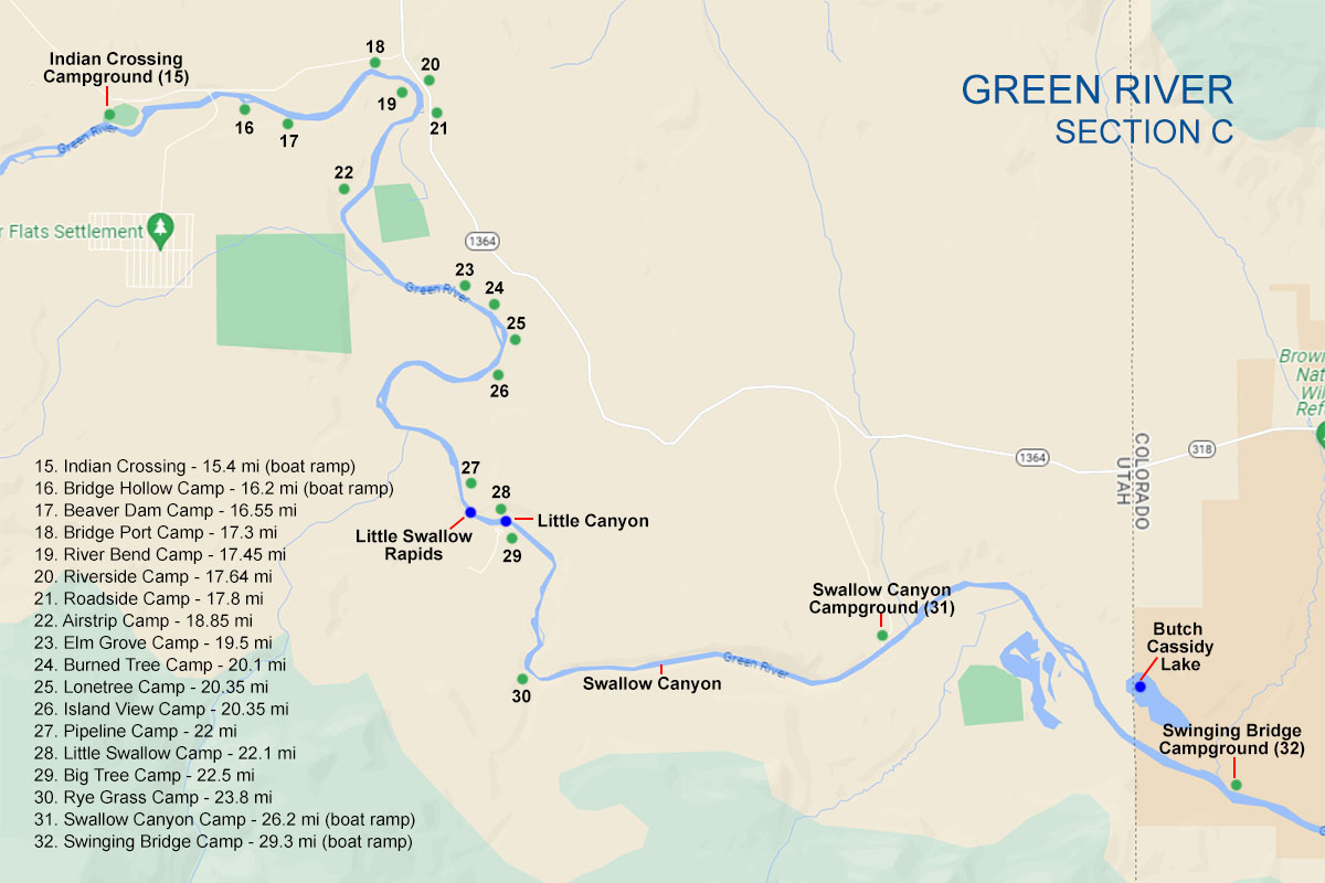
Section C – Lunker City!
Section C extends from Indian Crossing 11.5 miles through the desert valley of Browns Park National Wildlife Refuge to Swallow Canyon Ramp or Swinging Bridge on the Utah/Colorado border. Section C is rumored to have the largest fish on the Green River, but they can be challenging to catch. This section is character by low gradient, slow waters, and shallow riffles. It’s sometimes referred to as the “lazy” section of the Green.
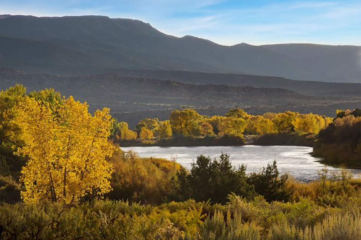
Section C has the warmest water of the three sections and anglers can expect to catch primarily brown trout along this stretch. Trout are not as abundant as on other sections, but they’re bigger—much bigger. Catching a 25″-30″ lunker on Section C of the Green is not uncommon. The best fishing occurs along the banks or our around structure found near riffles. During mid to late summer terrestrial patterns—especially ants and beetles—tend to get the big browns biting. To target some of the monster browns along this section try fishing mouse patterns in the late evening.
Float Fishing the Green
Floating in a drift boat is one of the more popular and enjoyable ways to fish the Green River. There is ample shore and wade fishing access along several stretches of the Green River—particularly Section A. But if you want to take in all the river’s beauty, and access the top fishing spots, you really a good drift boat. Float fishing opportunities exist along sections A, B, and C. Float trips along sections A and B can typically be completed in under a day. Float fishing the entirety of Section C takes a little longer and the trip is often spread across two days, although it can also be completed in under a day as well.
Section A Float Trip – (7 miles/3-4 hours)
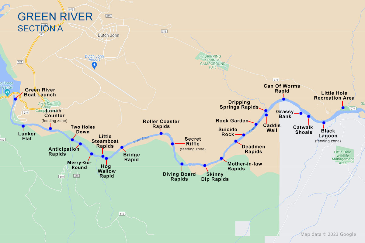
Float routes pretty much align with the three sections of the river. The first float route starts just below the dam on Section A and runs through the Red Canyon to Little Hole recreation area 7 miles downstream. Put-in is from the east side of Flaming Gorge Dam which can be reached westbound from Dutch John, UT or northbound from Vernal, UT on US 191. Take the FR 219/Spillway Boat Launch Rd to the south. The road runs 1.4 miles to a parking lot and the boat ramp.
The Section A float trip takes about 3-4 hours to complete. This route contains the most rapids, although they’re all beginner friendly, Class II or smaller. The float fishing is great but camping along the banks isn’t allowed so be prepared to float the entire route. The scenery along this route is truly unreal and you’ll enjoy the entire trip while fishing and relaxing from your drift boat or raft. You’ll take out on north side of the river at the Little Hole Boat Launch Area.
Section B Float Trip – (8 miles/3-4 hours)
| Campsite | Side of river | Distance from dam | |
|---|---|---|---|
| 1 | Stonefly I & II | North (left) | 8.2 mi |
| 2 | Sand Camp | North (left) | 8.3 mi |
| 3 | Bootleg Camp | North (left) | 8.42 mi |
| 4 | Cats Paw Camp | North (left) | 8.55 mi |
| 5 | Cottonwood Camp | North (left) | 8.60 mi |
| 6 | Grasshopper I & II Camp (Devils Hole) | South (right) | 9.35 mi |
| 7 | Jackson Creek Camp | South (right) | 9.65 mi |
| 8 | Cicada Camp | South (right) | 9.9 mi |
| 9 | Trails End Camp | North (left) | 10 mi |
| 10 | Big Pine Camp I & II | North (left) | 10.5 mi |
| 11 | Pugmire Pocket Camp | South (right) | 10.75 mi |
| 12 | Backwater Camp | North (left) | 11.6 mi |
| 13 | Red Creek Rapid Camp | South (right) | 11.9 mi |
| 14 | Tree Tops Camp | South (right) | 12.2 mi |
| 15 | Indian Crossing | North (left) | 15.4 mi |
The Section B float trip takes about 3-4 hours to complete and runs 8 miles from Little Hole recreation area downstream to Indian Crossing. The majority of this float trip is quite mellow until you hit the Red Creek Rapids at about the half way point. While it can be a bit challenging, this Class III rapid is easily scouted and maneuvered as long as you’re paying attention.
There are 17 good hike-in or float-in only campsites along Section B that can be reserved in advance online. If fishing isn’t your only objective, reserving a camp spot and spending a little time on the Green River is more than worth the trip in my opinion. It turns your float trip into an experience you and party will relish for years to come.
Camping reservations can also be made at the Little Hole Boat Ramp but I highly recommend booking in advance online if you want to guarantee yourself a camp spot.
Put-in for the Section B float trip is at the boat launch at Little Hole Recreation area. From the city of Dutch John, UT, just northeast of the dam, take Center St west to W Little Hole Road. Follow the road about 5 miles southeast to Little Hole Recreation Area. You’ll take out on the north side of the river at Indian Crossing Campground.
Section C Float Trip – (11.5 miles/5-7 hours)
| Campsite | Side of river | Distance from dam | |
|---|---|---|---|
| 15 | Indian Crossing | North (left) | 15.4 mi |
| 16 | Bridge Hollow Camp | South (right) | 16.2 mi |
| 17 | Beaver Dam Camp | South (right) | 16.55 mi |
| 18 | Bridge Port Camp | North (left) | 17.3 mi |
| 19 | River Bend Camp | South (right) | 17.45 mi |
| 20 | Riverside Camp | North (left) | 17.64 mi |
| 21 | Roadside Camp | North (left) | 17.8 mi |
| 22 | Airstrip Camp | West (right) | 18.85 mi |
| 23 | Elm Grove Camp | East (left) | 19.5 mi |
| 24 | Burned Tree Camp | North (left) | 20.1 mi |
| 25 | Lonetree Camp | East (left) | 20.35 mi |
| 26 | Island View Camp | East (left) | 20.35 mi |
| 27 | Pipeline Camp | East (left) | 22 mi |
| 28 | Little Swallow Camp | East (left) | 22.1 mi |
| 29 | Big Tree Camp | West (right) | 22.5 mi |
| 30 | Rye Grass Camp | West (right) | 23.8 mi |
| 31 | Swallow Canyon Camp | North (left) | 26.2 mi |
| 32 | Swinging Bridge Camp | North (left) | 29.3 mi |
If you’re looking for serenity and relaxation a float trip down Section C is where it’s at—except for the bugs. Make sure to bring insect repellent. Most of the time you’ll be fine but during certain times of the year the insects can be bad. Float fishing Section C can take anywhere from 5 to 7 hours depending on whether you let the current do all the work or you’re willing to row. This is the lazy section of the river so the current is a bit slower.
Camping is allowed at both designated and non-designated camping sites. This is a big plus if you spur of the moment decide you want to camp, although I personally think the camping spots along Section B are a little nicer. Most of Section C camping spots will have fire rings and picnic tables, but they’re typically overgrown with weeds and the scenery isn’t what you’ll find upstream on sections A or B.
Again, there aren’t a lot of fish along this section of the Green, but the trout you can catch are likely to be the bigger browns. If you’re looking for quality over quantity—and have the patience of Job—you’ll enjoy float fishing Section C.
Put-in is at Indian Crossing Campground. It’s a bit of a trek in. From US-191 access Browns Park Rd (Hwy 1364) on the east side of the highway about 8 miles north of Dutch John, UT. Follow Browns Park Rd 20 miles to the Red Creek Rd. Turn right onto Red Creek Rd and follow the road west 2 miles to Indian Crossing Campground and boat ramp.
Take-out is at Swallow Canyon access. Head east on Browns Park Rd off US-191. Follow Browns Park Rd 25 miles to Swallow Canyon River Access Rd. The boat ramp will be at the end of the road. Some anglers opt to take out 3 miles downstream at the Swinging Bridge Campground just over the Colorado border.
Green River Fish Species
The most common fish species along the upper green river from Flaming Gorge downstream the Colorado border are brown trout, rainbow trout, and cutthroat. Browns and rainbows are by far the most popular species with a few cutthroats here and there.
Section A from the dam downstrean to Little Hole Recreation Area is full of browns and rainbows. This is where trout are most abundant. From Section B through Section C trout numbers dwindle, but the trout tend to be a little bigger.
Anglers will occassionally catch Mountain White, Common Carp and Northern Pike in the upper green. Most pike are found near the Colorado border toward the tail end of Section C.
| Fish Species | Description |
|---|---|
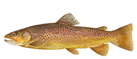 Brown Trout | The average size of brown trout on the Green River are 15-16 inches. Larger specimens up to 34 inches can be found along sections B and C. The Brown Trout Spawn in fall is a great time to target wild browns on the Green River. |
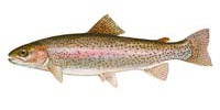 Rainbow Trout | Anglers report catching rainbow trout in the 15 inch range although they be smaller or larger. Larger rainbows will be found along Section B and to a lesser degree Section C. |
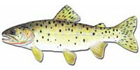 Cutthroat Trout | Cutthroat trout on the upper Green River are smaller in size and concentrations than either browns or rainbows. If you catch one it will typically be in the 13 to 14 inch range based on angler reports. |
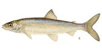 Mountain Whitefish | Average Mountain Whitefish on the upper Green River are between 10 and 14 inches, although slightly larger specimens have been reported. Mountain Whitefish are a rare catch. |
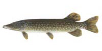 Northern Pike | Northern Pike are found in the Green River from Browns Park downstream through Dinosaur National Monument, Vernal, Jensen, and Ouray. Average size of pike is 16-20 inches, but you may find a lunker or two if you target them. |
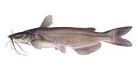 Channel Catfish | Channel Catfish are present but rare catches along the upper Green River. Most Channel Catfish are found downstream from Section C. Channel cats on the green river can reach up to 30 lbs but are typically in the 5 to 10 lb range. |
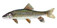 White Sucker | Although rare, the White Sucker is present in sections A, B and C of the Green River. They can reach up to 2 pounds and measure between 12 and 20 inchs. |
| The Flannelmouth Sucker is a rare catch on the upper Green River. They can grow up to 25 inches and 8 lbs, but on average are much smaller. |